The Madaba Mosaic Map: The Oldest Map of the Holy Land Found Under a Church Floor
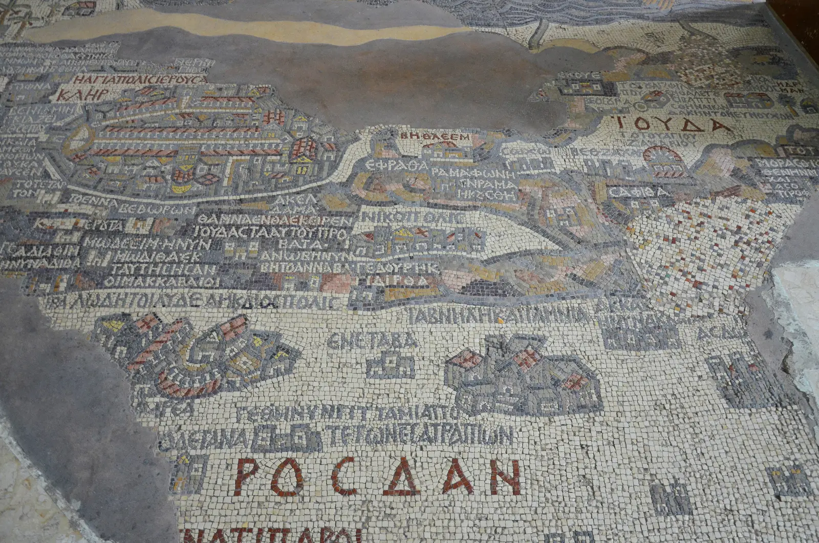
In a quiet church in the centre of Madaba, visitors gather around a floor. Beneath their feet lies a map made of tiny stones, laid by craftsmen around 1,450 years ago. It shows rivers with fish, boats on a salty sea and a walled city with its streets and churches.
A map beneath the rubble
In the late nineteenth century, Christian families settled in Madaba, which was then a small village built over the ruins of an ancient town. As they built houses and churches, they kept finding beautiful mosaic floors from the Byzantine period. In the 1880s, while a new Greek Orthodox church dedicated to Saint George was being built on the site of an older church, workers uncovered a large mosaic that seemed to show places and names.
At first, few people understood what had been found, and some parts were damaged during construction. Its true importance was recognised in 1896 and 1897, when scholars came to study it and realised that this was a map of the lands of the Bible, made in the sixth century. News of the discovery soon spread around the world, and visitors and researchers began to arrive in the small town.
What the map shows
The map was made around the years 560 to 565 AD, and it once covered a much larger area of the church floor. It is oriented with east at the top, towards the altar. Even the surviving section is full of life. The Jordan River flows down to the Dead Sea, and the fish in the river appear to swim away from the salty water. Two boats sail on the Dead Sea, and palm trees mark the oasis of Jericho.
The most famous detail is Jerusalem, drawn as an oval walled city with gates, a main colonnaded street and the Church of the Holy Sepulchre. Many places are labelled in Greek, including the place called Bethabara near the Jordan River, linked to the baptism of Jesus, and the hot springs near the Dead Sea. Small details, such as a gazelle and a lion, add life to the scene.
Why it matters
The Madaba Map is the oldest surviving original map of the Holy Land, and it is precious to historians, archaeologists and pilgrims. It helped researchers identify ancient sites and understand how cities looked in the Byzantine period. In Jerusalem, for example, excavations later confirmed the line of the main street shown on the map. Experts estimate that the complete map was made from around two million small stones, called tesserae, in many natural colours. Only a part of it survives today. In 1965 a team of specialists cleaned and restored the remaining section to protect it for the future.
Seeing the map in Madaba
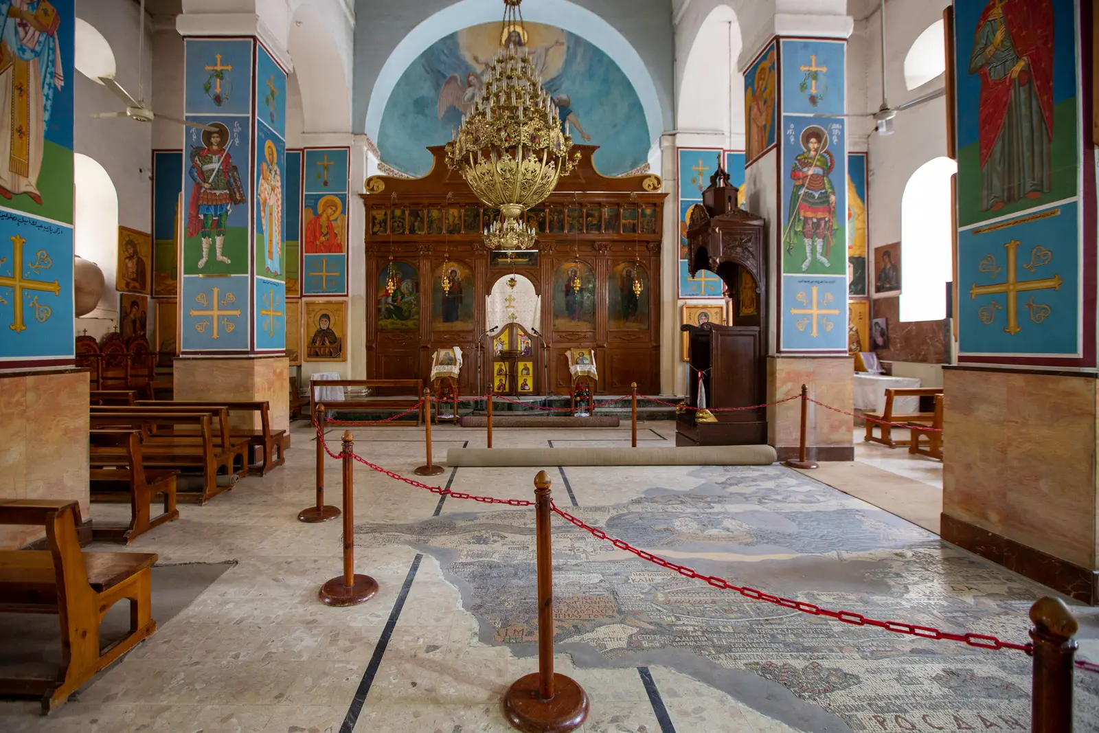
The map lies in the Church of Saint George in the centre of Madaba, which is still an active place of worship, so dress modestly and keep your voice low. Visit outside service times, and take a moment to walk around the edge of the map and find the Dead Sea, the Jordan River and Jerusalem. Madaba is often called the City of Mosaics. After seeing the map, you can visit the Archaeological Park, other churches with mosaic floors and a school where young artisans learn the ancient craft. Mount Nebo, with its own famous mosaics, is a short drive away.
Frequently asked questions
How old is the Madaba Map?
The Madaba Map was made in the sixth century AD, most likely between 560 and 565. That makes it around 1,450 years old. It is the oldest surviving original map of the Holy Land, made of small coloured stones set into the floor of a Byzantine church in Madaba.
When was the Madaba Map discovered?
The mosaic was uncovered in the 1880s, when a new Greek Orthodox church was built on the site of an ancient church in Madaba. Its full importance was understood in 1896 and 1897, when scholars studied it and announced that it was a sixth-century map of the Holy Land.
Where can I see the Madaba Mosaic Map?
The map is in the Greek Orthodox Church of Saint George in the centre of Madaba, about 30 kilometres southwest of Amman. The church is a place of worship, so visitors should dress modestly and avoid service times. Madaba has many other mosaics nearby, and Mount Nebo is a short drive away.
More stories
The Silent Faces of 'Ain Ghazal: Among the Oldest Statues of the Human Form
Jerash: The Roman City That Slept Under the Earth
Masters of Water: How the Nabataeans Made the Desert Bloom
The Language of the Cup: Bedouin Coffee Rituals in Jordan
Three Days and a Third: The Bedouin Code of Hospitality
The Story of Mansaf: Jordan's Feast Around One Tray
The Black Iris: The Dark Flower of Jordan's Spring